Located between the Littoral and South-West Regions of Cameroon, Mount Manengouba rises to 2,411 meters.
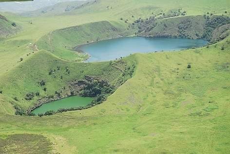
Mount Manengouba is situated in the Koupe Manengouba Department of the South-West Region. Surrounded by lush tropical forest, it features a pair of crater lakes shaped like the African continent. The vibrant green and blue waters of these lakes have earned them the name “twin lakes” from the local Koupe Manengouba communities. One lake is referred to as the female lake, while the other is the male lake.
The volcanic history of Mount Manengouba comprises four main stages: the formation of an early shield volcano, the construction of the Eboga stratocone, the caldera collapse and silicic extrusion of the Eloungoum complex, and the intra-caldera and flank activities. The mountain features two nested sub-circular calderas, along with broken cones and domes.
Land use conflicts arise due to the fertile soils that support farming in the lower slopes of the volcano. Additionally, the highest of the Bakossi Mountains boasts four watersheds: River Manyu, River Nkam, River Moungo, and River Woun.
The area is home to several primate species, including the endangered drill, chimpanzees, Preuss’s red colobus, red-eared guenons, and putty-nosed monkeys. Other notable mammals include blue duikers, sitatungas, red river hogs, red-fronted duikers, and large-tailed pangolins.
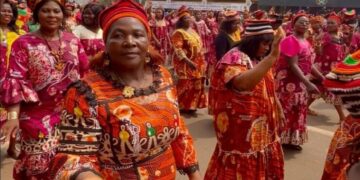
Bangem serves as the main town of the Koupe Manengouba Division, where the population primarily consists of the Bakossi, Bafaw, Balong, Bassossi, and Mbo ethnic groups. The local economy is largely based on agriculture, with cocoa, coffee, oil palm, rubber, and tea farms being the main activities.


